the West Side
Kuilioloa Heiau
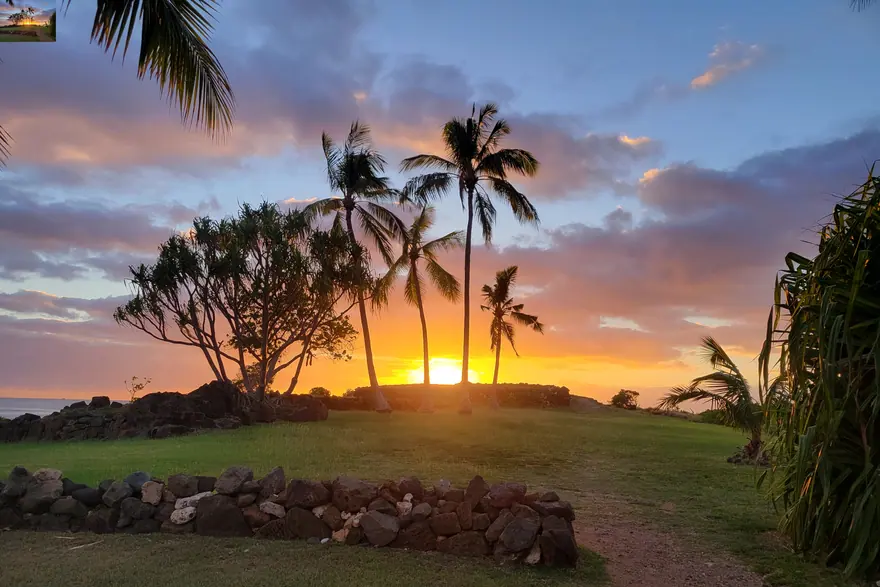
A heiau on the point at the end of Pokai Bay, out over the water on three sides.
Why go
The setting does the work. It sits on a spit with the Waianae range behind it and the bay on either side, and almost nobody is there.
The catch
The beach park it sits in is a local one and can be busy at weekends. Do not leave anything in the car.
- How long
- 30 min
- With children
- Yes
- Effort
- Easy
- Cost
- Free
- Parking
- Easy
Getting there
Driving times on real roads, from the same data the trip planner routes on — not straight-line distance.
| From Waikīkī | 1 hr 2 min | 36.5 miles |
|---|---|---|
| From HNL airport | 1 hr 3 min | 33 miles |
| From Mākaha | 10 min | 3 miles |
| From Ko Olina | 24 min | 10.2 miles |
Add traffic. These are free-flowing times, and the H1 through town at eight in the morning is not free-flowing.
More on Kuilioloa Heiau: OpenStreetMap
Hours, fees and access rules have not been checked against a primary source for this entry yet. Confirm before you build a day around it.
See it on the map Build a trip around it
What else is close
Nearest by road, which is not the same as nearest on a map — and not the same as sharing a region either.
- Kaneaki Heiau16 min awayA fully restored heiau up Makaha Valley, with reconstructed thatched structures.
- Kaneana Cave17 min awayA tall limestone cave cut into the cliff on the Waianae coast, a few steps off the highway.
- Ko Olina Lagoons23 min awayFour man-made lagoons on the dry west side, each one ringed by rock so the water barely moves.
- Wet'n'Wild Hawaii26 min awayThe island water park, out at Kapolei on the dry side.
- Kaena Point, Keawaula end29 min awayThe end of the road on the west coast, and the trail out to the northwest tip of the island.
- Kaena Point, Mokuleia end34 min awayThe North Shore approach to Kaena Point, past Dillingham airfield where the road runs out.